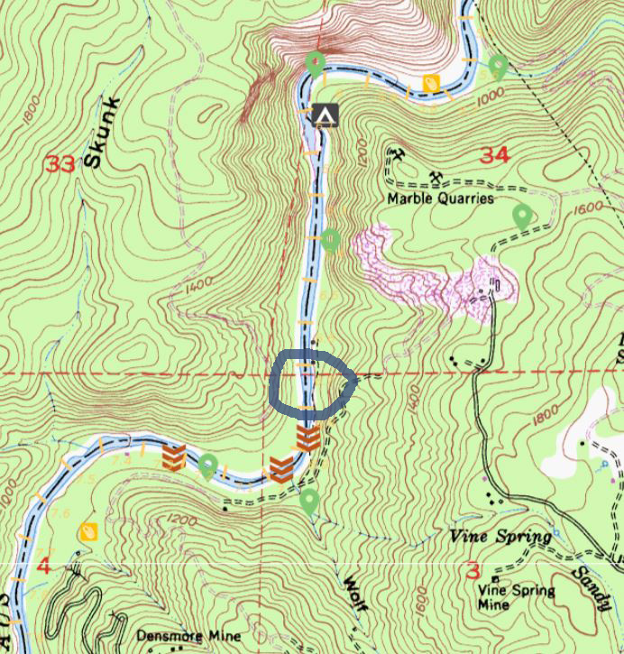


Abbey’s Ferry location map
From the book, A Guide to Three Rivers: “Before the first Melones bridge was completed in 1907, travel between the southern mines of the Sonora area and the diggings on the Calaveras side depended almost totally on the Stanislaus ferries. Between Melones and Camp 9 there were four, the highest of which was Abbey’s Ferry, located in the calm, wide stretch just below the marble quarry, at mile 6.7. Today, the clearest evidence of the operation are the old roads which come down from both sides to face each other on opposite banks. On the Calaveras side, the road connects to the Camp 9 road via Skunk Gulch. Over on the Tuolumne side, the route joins with the Parrott’s Ferry Road via the Marble Quarry drive. George W. Abbey started the ferry in 1851, some nine years before Thomas Parrott began his operation just downstream. Over the next ten years it changed hands at least half a dozen times before ceasing operation in 1863.It may be most famous for the death of the circus elephant Victoria in 1860; due to high water, Victoria couldn’t ride the ferry and had to swim but she was seriously bruised and died two days after.”
Date uploaded: Aug 28, 2018
Date last modified: Apr 17, 2024