

Map showing the topography of the Stanislaus River
Status:
Live River
By:
GreenInfo Network
Date:
2000
Description:
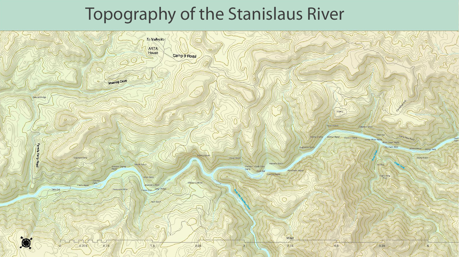
An overview of the topography of middle part of the nine-mile section of the Stanislaus traveled by so many – So. Fork Stanislaus comes in from the bottom in center, Rose Creek from bottom at right. Done as a test in 2000 to assess how to locate what was lost in the flooding.
Keywords:
River
Format:
Other Image
Collection:
Admin's Collection
Rights:
Copyright GreenInfo Network 2000
Date uploaded: Oct 30, 2018
Date last modified: Oct 30, 2018