New – Google Earth kmz files for the Stanislaus River and Feature Points
June 15, 2021
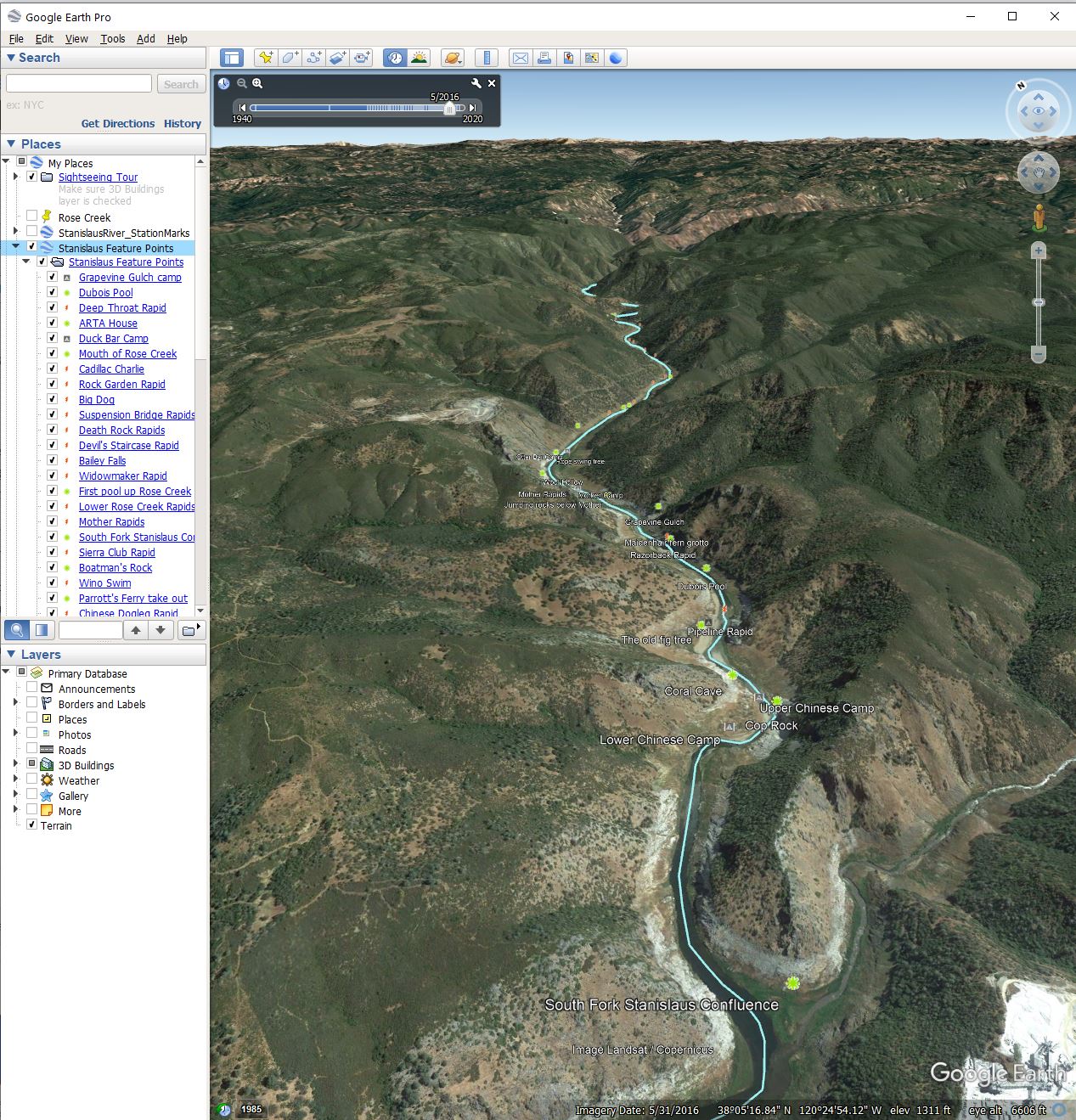
Now you can explore the Stanislaus River as it was on you own, by downloading these two Google Earth files:
- StanisRiver_Albers83.kmz – this is the river’s center line, helpful for understanding exactly where it flowed – download it now (10kb)
- Stanislaus_Feature_Points.kmz – these are the rapids, camp sites, and other places along the river that have been used in the Archive location category (there are symbols pre-defined for each of these feature types) – download it now (10kb)
The best view of the river is provided by choosing May 2016 in the Historical Imagery tool at the top of the Google Earth screen (other time points just show a flooded river or are at very low resolution).
To get Google Earth Pro (best software to use, vs. the simpler standard versions), go to https://www.google.com/earth/versions/ and scroll down to Google Earth Pro for Desktop computers.
More tips on using your mouse and keyboard to navigate in Google Earth Pro here – below is what the two files look like displayed in Google Earth Pro with May 2016 imagery selected.