‘Crime Scene’ Analysis – Stanislaus River Version (did Cop Rock do it??)
July 06, 2021
One of the fun parts of managing the Stanislaus Archive is re-discovering all the places that had slipped away from memory. But with some modern mapping tools and lots of comparisons of images in the archive, it’s possible to figure out a lot of photo locations that otherwise might not get determined.
Here’s a good example – In Bruce Raley’s Collection there are a series of several images of a major boat wrap. But where did this take place? Or in CSI style, whodunnit? An initial view suggested that maybe this wasn’t even on the Stanislaus River at all. But by looking at Bruce’s original slides and their Kodak-stamped dates, it was pretty clear that they and others were on the Stan. So, where, exactly?
Knowing the river certainly helps, because there aren’t too many places where the river bends left (shown in the photos) and a big rock bar is river right (also shown). And our prime suspect has a notorious rock as its namesake – legend has it a boat carrying police officers made the initial wrap on the rock, hence the name, Cop Rock Rapid, located right on the bend in between Upper and Lower Chinese Camp, just below Duck Bar.
But was it really Cop Rock?
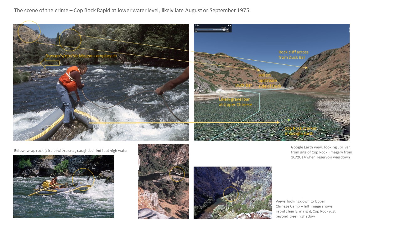
Now the clues need some modern day forensics. The best tool for this is Google Earth Pro, which allows a user to pretty much approximate the angle of a scene and then to use various years of satellite imagery to find a time when the reservoir was far down, revealing the river bottom and shorelines (wrecked though they may be, sigh).
The result of the analysis is summed up in the image below, showing all the clue lines that went into making sure that Cop Rock was Guilty, Guilty, Guilty! (a shout out to an old Doonesbury cartoon..). See the full set of photos here: https://www.stanislausriver.org/story/epic-boat-wrap-at-cop-rock-rapid/