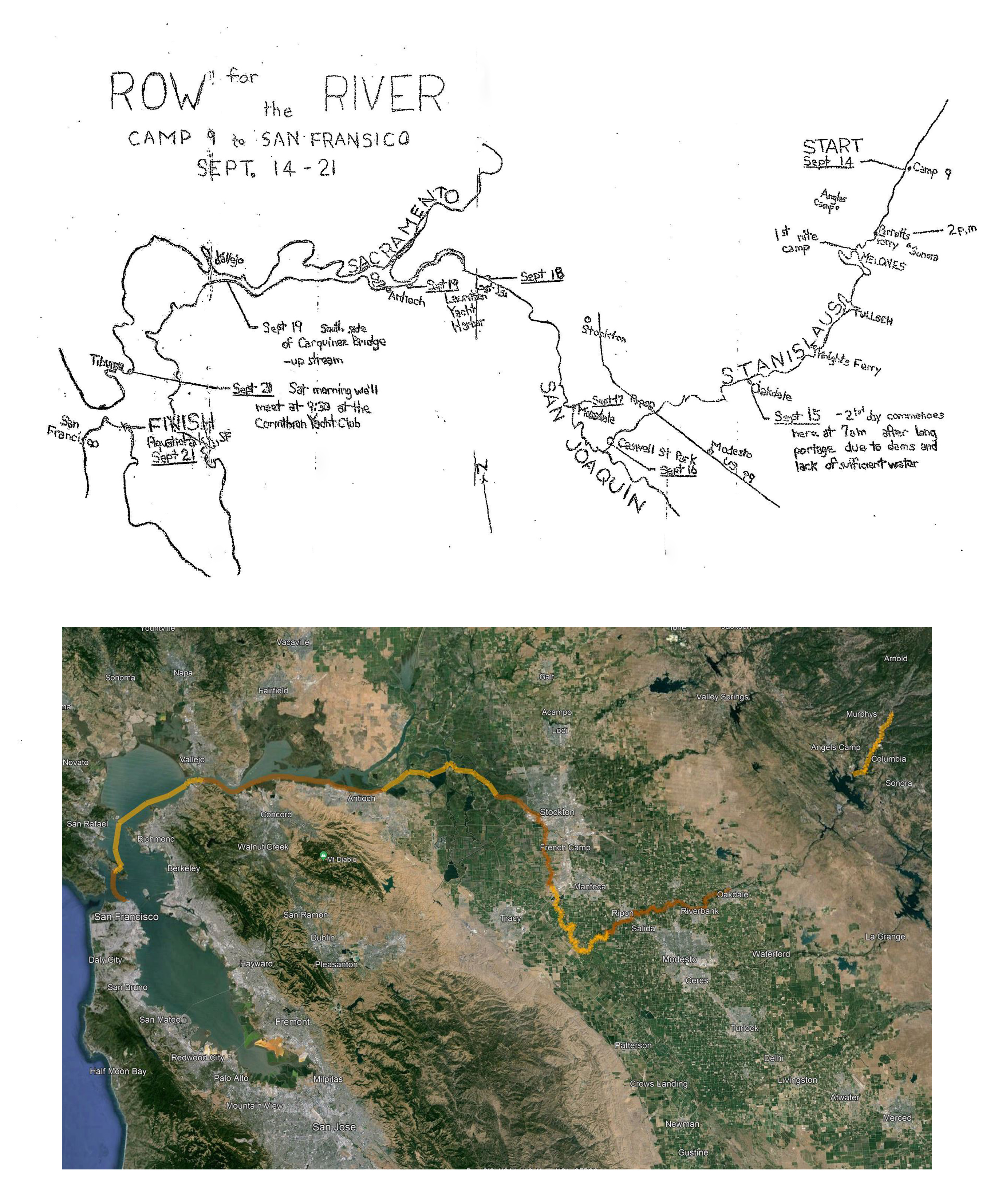


The route of the 1974 Row for the River
These two maps – the original created in 1974 and a modern version with satellite imagery – show the 8 day-long segments of Row for the River, from Camp Nine on Saturday, September 14th, to San Francisco’s Aquatic Park on Saturday, September 21st. 20 paddlers made the entire 175 mile journey, which was to draw attention to Proposition 17 on the November ballot. 100 paddlers of all kinds joined for the final day, from Tiburon to San Francisco. The segments were: 1) Camp Nine to Melones/Robinson’s Ferry – 15 miles; 2) Oakdale to Caswell State Park (33 miles); 3) Caswell to Mossdale Park in Lathrop near Stockton – 27 miles; 4) Mossdale to Lost Isle – 22 miles; 5) Lost Isle to Antioch – 20 miles; 6) Antioch to Crockett/Carquinez Bridge – 28 miles (very tough, windy section); 7) Crockett to Tiburon – 22 miles; 8) Tiburon to San Francisco – 5.5 miles.
Date uploaded: Apr 17, 2024
Date last modified: Apr 26, 2024